The Herbal Book of Pietro Andrea Mattioli
16 May 2024
8 Min.
Collecting
16 August 2023 Reading duration 11 Min.
A glance at the collections of the Deutsches Historisches Museum reveals the immense variety of objects that are related to different epochs and topics of German history. They tell stories of our past or current lives, of famous or often unknown persons and events. In our series “Umwelt sammeln” we present various objects that have to do with the topic of “environment”. Unexpected questions raised by the heads of the different collection sections open new perspectives on historical objects and often reveal startling parallels to questions that deal with our current world.
In part 2 of our series, Sven Lüken, former head of the militaria collection, uses one of the earliest maps in the DHM collection, which shows changes in the seashore brought about by storm surges, to highlight the perception of catastrophic storm surges from the Middle Ages to the present.
Detail from: Flood in Low Germany in 1717, copperplate engraving, coloured, published by Johann Baptist Homann, Nuremberg, around 1720, Berlin, 1988/1869 © DHM
The phenomenon
With floods we now automatically think of climate change. But they are certainly not only a phenomenon of our time. In the High Middle Ages, from 950 to 1250, there was an interglacial period throughout Europe, although it varied from region to region. The reasons and peculiarities of this overly warm period are not known and data collection did not exist, but one thing is certain: people were not the cause of it – there were not enough people at the time. But even then the results of this temperature increase already had consequences. Grain was grown in northern Scotland, Greenland and Norway, and vineyards flourished in Schleswig-Holstein, because the climate was warm and humid.
During to this medieval interglacial period, the sea level rose and storms grew stronger – like today. When the storm surges began to occur more frequently, the people who had settled on the originally flat coastline of the southern part of the North Sea heaped up artificial hills or mounds around their settlements. By the end of the 13th century, they had succeeded in building an initial uninterrupted dyke line along the coast. In the 15th century, the precursors of the “Little Ice Age” announced the coming of a general transition to a relatively cool climate period.
When a stiff northwester blew towards the so-called German Bight (Bay) for several days at a time and a particular sun-earth-moon constellation created a spring tide causing an extreme swelling of the tides, and when finally excessive rain or defrost water from the great Rhein, Weser and Elbe rivers influenced the sea level, a dangerous storm surge could occur, the so-called “Blanker Hans”. In such a case it depended on whether the people had built the dykes or mounds high enough and whether the protective structures such as sluices, floodgates and ports were in good condition.
At first the building and maintenance of dykes was the duty of the inhabitants, but it was then taken over by the local authorities of the coastal communities of Friesland. The Frisian lands with their fellowship order had difficulty accepting the nobility, who held sway elsewhere in Europe. But in times of crisis, prominent aristocrats took on the job of building the dykes. In the 14th century, an aristocracy grew up in most of the coastal lands. The nobles often built castles, which had previously been forbidden, on new territory or on their properties, where they also erected their own dykes.
In the course of the Middle Ages, numerous storm surges ravaged the land along the German Bight. We know nothing about most of them, because no chronicler had the time or the inclination to protocol these catastrophes. For the most part only the dates are known, often oriented on the days of the saints of the Christian calendar – for example, the “Second Saint Marcellus Flood”.
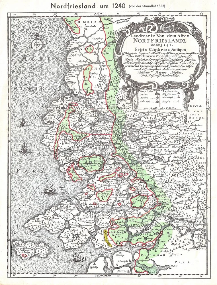
Reconstructed coastline of North Frisia before the Marcellus Flood of 1362. The red line shows the present coastline that was formed for the most part after this flood. (from: Wikipedia: public domain)
1362 – The “Grote Mandrenke” in climate change
On 15 January 1362, the day of the holy pope St. Marcellus, a storm surge swelled over the entire southern coast of the North Sea, with devastating consequences. Here, too, there are few exact reports, but there is growing evidence. The disaster known as the “Second Saint Marcellus Flood” – the “First Saint Marcellus Flood” occurred on the same calendar day in the year 1219 – caused permanent changes in the coastline. Islands were destroyed, divided or created, and large stretches of land on the mainland disappeared over night. In East Frisia the Dollart, Leybucht, Harlebucht and Jadebusen bays were decisively enlarged; in Schleswig-Holstein the former coastline was completely lost and the Halligen were formed. Estimates suggest that up to 100,000 people lost their lives. Rungholt, still considered a mythical city, disappeared completely. It is certain that 30 villages were destroyed in one night; altogether 44 villages were washed away when the storm tide wrecked the dykes. Many others were cut off from their surroundings and became islands. The disaster was so great that the Marcellus flood is still known by its nickname “De Grote Mandrenke” – the “Great Drowning of Men”.
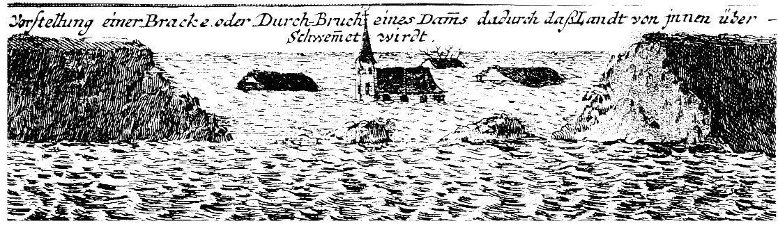
Both Nature and Man bore blame for the catastrophe. Decades had passed since the dyke line had first been completed. In the meantime the sea level had risen, probably several decimetres. Above all, the flood waters rose higher when they came up against the dykes, because the water had less room and backed up. Surrounded by dykes, the land had begun to sink through erosion and desiccation. In many areas the peat was harvested from the moors behind the dykes to be used as fuel – an ecological misdeed that causes deep, black-coloured bodies of water to form when seawater flows in, as can be seen in the “Schwarzer Brack”, the brackish water habitat southwest of Wilhelmshaven. And finally, it was the plague known as the Black Death around 1348 that further caused the survivors to neglect the dykes.
While up to this time it was only the cultivated tracts of land that were protected by dykes, the strategy now changed. After the catastrophe of the “Grote Mandrenke” they began to proactively build dykes on new land in order to regain what had been lost. With the emergence of the early modern territorial state after the Reformation, the new local nobles took on the role of dyke builders. Dyke construction became a task of the ruling classes; the cooperatively ordered Frisians could only act as day labourers. The newly gained marshlands were called “Koog” in North Frisia, analogous to “Groden” and “Polder” in East Frisia. These epithets from the nomenclature of the princes and princesses reveal who had the say.
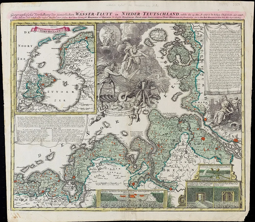
Homann’s map from the DHM collection is one of the first that precisely shows the advance of the water into the hinterland. Homann later published the map in an atlas, which increased its fame. Johann Baptist Homann: Grosser Atlas Uber die Gantze Welt …, Nuremberg: Homann, 1726 (Bibliothek, B 52/3476, Nr. 228, Berlin) © DHM
When humanity wages war – the “Christmas gift” of 1717
The Christmas flood of 1717 was not only one of the severest storm surges of all time, but unlike earlier storm floods was recorded in written documents and even clearly depicted in a picture. The map from the DHM collection shown here was published by the Nuremberg cartographer Johann Baptist Homann. The advance of the water masses is clearly illustrated in this detailed and reliable map of northern Germany. The map also contains a written report about the flood and shows in an insert on the lower edge how buildings were flooded and dams broken. Unlike in the case of the “Second Saint Marcellus Flood”, the events here were not only recorded from personal, often oral accounts, but also verified by the detailed, accurate depiction on the map.
After a long stretch of southwesterly weather conditions on 24 December 1717, a deep North Atlantic low pressure system reached the western coasts of the Netherlands and Germany from the northwest. Towards evening the wind died down but freshened again around midnight. The flood surprised the people in their sleep. The waters streamed over the edge of the geest of the marshlands. Ships sailed and stranded where they had no business being.
When the water flowed away after three days, the loss of land was within reasonable bounds. But alone on the German North Sea coast some 9,000 persons had died and in neighbouring Netherlands another 2,500. The statistics-savvy Age of Mercantilism listed exactly what else had been lost: 2,500 horses, 9,500 cattle, 2,800 sheep, and 1,800 pigs. Alone in East Frisia some 900 houses had been washed away and 1,800 damaged.
The worst results came from new floods in the following year. They buried the land in water because the people had been too exhausted to rebuild the dykes. The soil became oversalted and the livestock that had survived could no longer be fed. Disease spread and the peasants who had suffered the least bought up the land of their neighbours at cutthroat prices, leading to a concentration of ownership. Part of the population emigrated, although it was forbidden.
Why did this happen in 1717? It was not caused by a sudden climate change. Meanwhile it was the phase of the “Little Ice Age” and the sea level had sunk again. But other occurrences had led to a neglect of the dykes. During the Spanish War of Succession, which was fought throughout Europe from 1701 to 1713, the Netherlands had worn itself out as a leading power. In the neighbouring earldom of East Frisia, the count, or “chieftain”, and the estates were engaged in a violent conflict about rights between estates and princely absolutism. In the duchy of Oldenburg the traditional dynasty came under the authority of Denmark, which had the Frisian lands be ruled by foreign officials whose commitment and assertiveness were not up to the task of major projects such as dyke building. In Butjadingen, which was part of Oldenburg, 30% of the population died in the flood. Finally, the Great Northern War was being waged from 1700 to 1721 between Russia, Saxony-Poland and Denmark-Norway on the one side and Sweden on the other. And therefore fighting was going on in the Swedish duchy of Bremen-Verden and in Danish Schleswig-Holstein immediately before the Christmas Flood of 1717. In the meantime, the construction and maintenance of the dykes was completely in the hands of principality, which had forced the communities out and made the population pay duties. But who fights against the sea when princes are battling against one another?
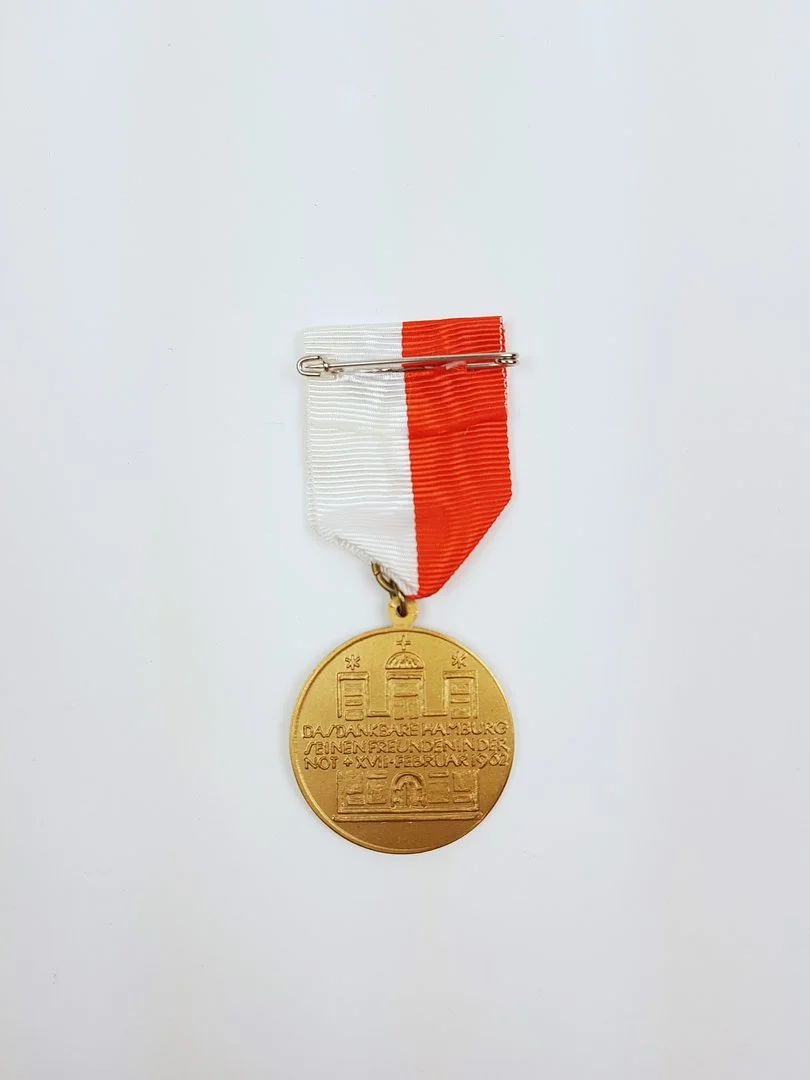
Storm surge memorial medal 1962 – Hamburgische Dankmedaille, Inv.Nr. O 99/6 © DHM
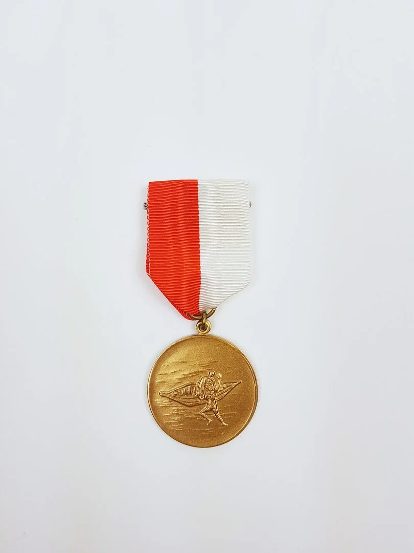
A man wants to rise to the top – 1962 and the beginning of a myth
Storm surge memorial medals were minted in Niedersachsen, Schleswig-Holstein and Hamburg and awarded to helpers. But the Free and Hanse City of Hamburg did not award decorations and medals of honour to its citizens, but medals of thanks to non-resident helpers.
Due to technical advances, the 20th century believed that natural catastrophes had been overcome. But that storm surges of the North Sea could still have serious consequences was proven by the storm flood of 16 and 17 February 1962, which received a traditional saint’s name and was called the Second Julian Flood.
For weeks the stormy weather had been forcing the water into the German Bight like into a funnel so that the high tide could not flow back. On 15 February the storm grew to hurricane force and turned in a westerly direction. And it began to rain. In Germany the rear river marshes were affected, particularly in the Free and Hanse City of Hamburg. They had been the target of Allied bombing attacks in the Second World War. Most of the dykes that had been hit had been only tentatively mended with wartime rubble, and part of the population was still living in makeshift houses that had been quickly installed in public parks and allotments and which offered no protection against floods. The roofs could not even act as platforms for evacuation. Some of the dykes had been used for gardening and without turf they were laid bare to the erosion of the flood waters.
In the metropolis Hamburg the militarily structured disaster response developed in the Second World War had been discontinued after 1945. While it was quickly possible to remedy the situation in other more loosely structured northern German regions in Bremen, Niedersachsen and Schleswig-Holstein with the help of the American and British occupation troops and the Bundeswehr, Hamburg sank not only in water, but in chaos as well. The television station at first refused to broadcast a storm surge warning so as not to interrupt a favourite TV series. The mayor was away on holiday, and other important functionaries remained in their homes.
And so it came that in Hamburg the dykes broke in more than 60 places and the Hanse city stood under 120 square kilometres of water. 315 people perished and 20,000 were made homeless; later thousands of dead cattle, pigs and chickens were counted, and the property damage amounted to about three-quarters of a billion Marks.
The situation would have become ever worse if the Hamburg Senator of the Interior had not gone to his office and pulled together a crisis team. It was the Social Democrat Helmut Schmidt who, in the vested attitude of a former Wehrmacht officer, felt called upon to act without constitutional backing and to request the aid organisations and the military to offer their support. As Senator of the Interior he knew the police and disaster authorities, as defence expert the generals, and he did not hesitate to call for their help. And indeed, he created a myth, for what he was able to achieve in Hamburg with his powerful eloquence had already been taken care of in the other flooded areas in relative silence. His actions not only rehabilitated the energetically intervening former Wehrmacht officer. As Hamburger, Helmut Schmidt did not receive a medal of thanks like non-residential helpers. But the “Schmidt myth” he created in Hamburg in 1962 brought him in 1974 to the chancellorship in Bonn and later into the hearts and minds of the people of West and East Germany.
Conclusion
In its geography, the region of the German Bight is one of the areas worldwide that are most seriously threatened by storm surges. In the course of centuries, whether in particularly warm periods or in times of cold weather, the sea has caused losses in land and has influenced social, economic and political developments. Only consequential dyke construction promises protection from surprises of the elements. People can not yet influence the temporary rise of sea level caused by wind and other natural phenomena – the storm surge itself. But it appears that this is changing – though our influence on the current change in the climate.

Until 2025, Dr Sven Lüken was Head of the Militaria Collection – comprising weapons, armour and military equipment – at the Deutsches Historisches Museum.
The Herbal Book of Pietro Andrea Mattioli
16 May 2024
8 Min.
Collecting
An Amazing Form of Public Opposition. Environmental posters from the GDR by Manfred Butzmann und Martin Hoffmann
17 April 2024
7 Min.
Collecting
Making money out of natural materials – Porcelain emergency money
13 March 2024
6 Min.
Collecting
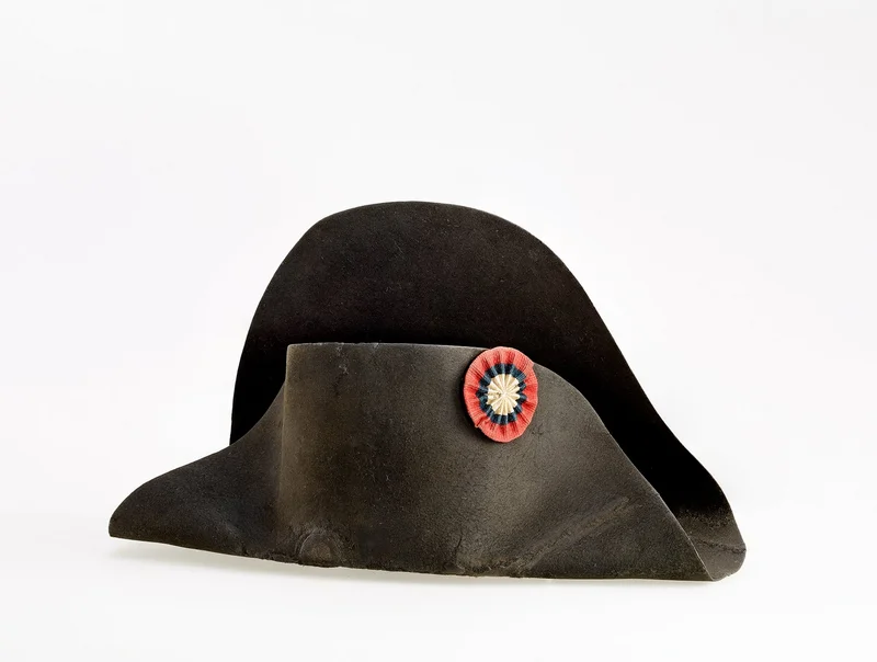
Napoleon’s Wet Hat
13 December 2023
8 Min.
Collecting

Embroidery as a Medium for the Representation and Ordering of the World
15 November 2023
6 Min.
Collecting
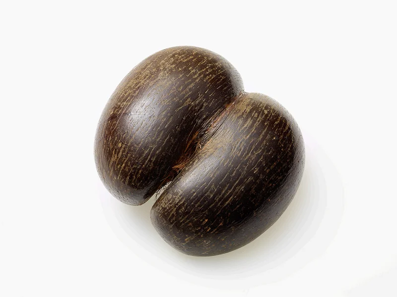
Coco de Mer – A Nut in the Museum’s Collection
19 October 2023
5 Min.
Collecting
“We’re cutting off the branch we’re sitting on!”
20 September 2023
6 Min.
Collecting

This comes into/onto the bag
14 July 2023
5 Min.
Collecting
The Herbal Book of Pietro Andrea Mattioli
16 May 2024
8 Min.
Collecting
An Amazing Form of Public Opposition. Environmental posters from the GDR by Manfred Butzmann und Martin Hoffmann
17 April 2024
7 Min.
Collecting
Making money out of natural materials – Porcelain emergency money
13 March 2024
6 Min.
Collecting
Napoleon’s Wet Hat
13 December 2023
8 Min.
Collecting
Embroidery as a Medium for the Representation and Ordering of the World
15 November 2023
6 Min.
Collecting
Coco de Mer – A Nut in the Museum’s Collection
19 October 2023
5 Min.
Collecting
“We’re cutting off the branch we’re sitting on!”
20 September 2023
6 Min.
Collecting
This comes into/onto the bag
14 July 2023
5 Min.
Collecting